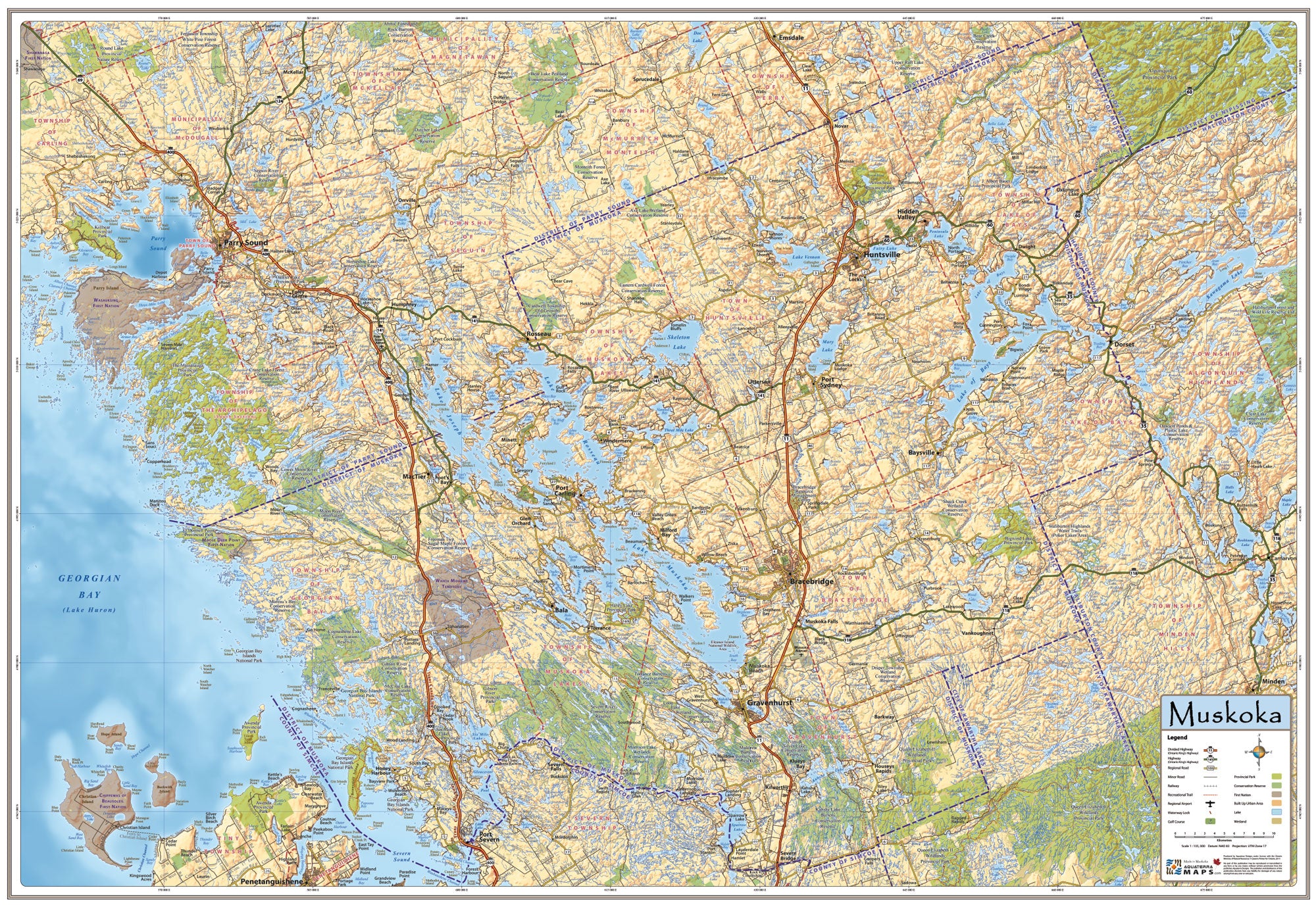
Muskoka Map
The Muskoka Map is a detailed overview map displaying the Muskoka landscape like no other map ever created.
The Muskoka Map was developed by meshing traditional cartographic principles with historic graphic style to design a map that functions as a stunning decorative wall map, while at the same time guaranteeing spatial accuracy.
With the map coverage stretching from the rugged shores of Georgian Bay in the west to Lake of Bays in the east, the lake dotted and glacier scoured landscape of Muskoka is displayed in vivid detail.
Size: 39" wide x 27" tall
Coverage Area: The majority of the Official District of Muskoka.
Features: Highways, Major Roads, Cottage Roads, Provincial Parks, Conservation Areas, Golf Courses, Airports, Waterway Locks, Detailed Relief Shading.