Parry Sound Map
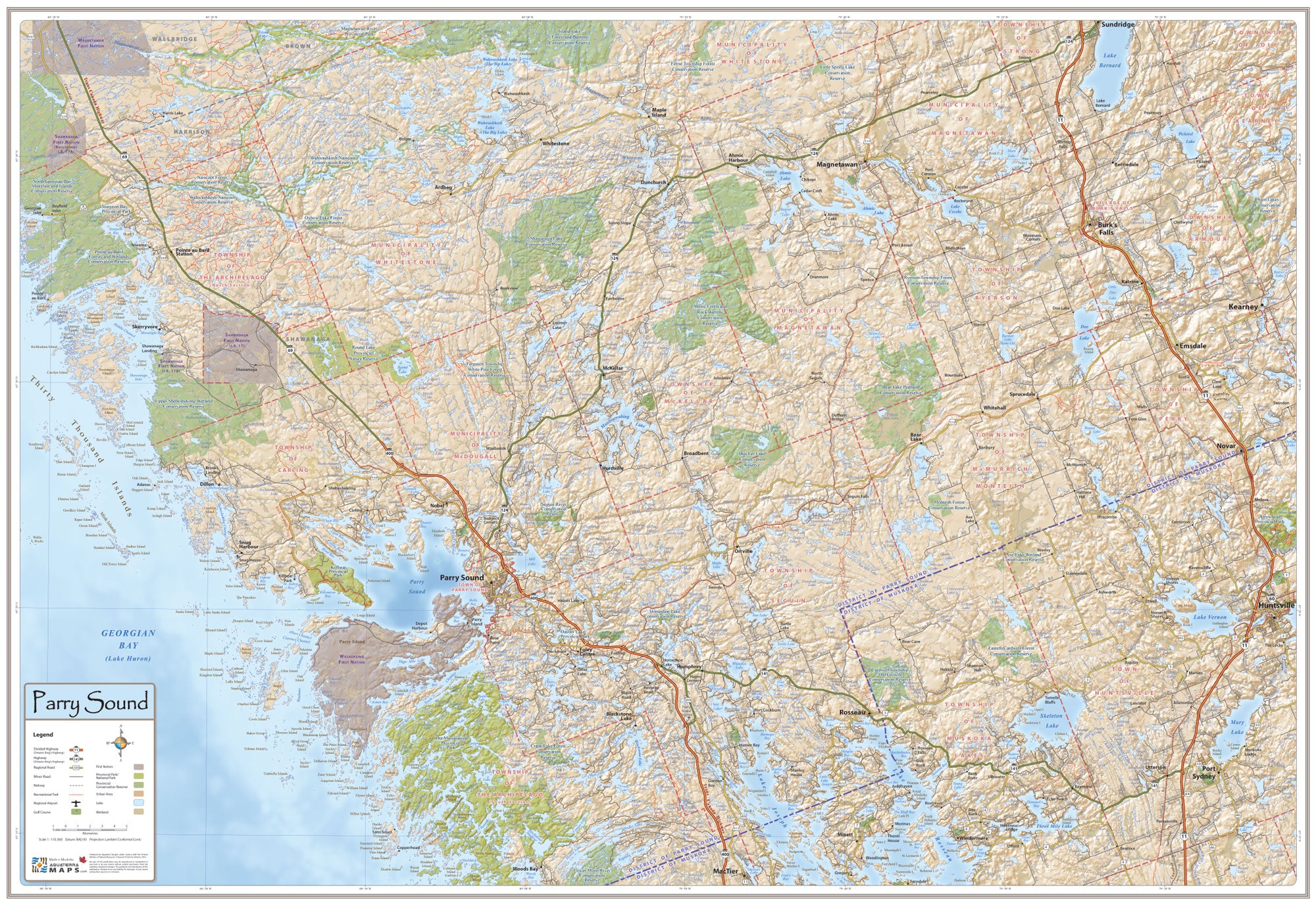
This beautiful Parry Sound Map lets you gain a detailed regional perspective of this captivating lake-dotted landscape. Use this wall map at your cottage, home, or office to introduce visitors to the area, plan your next outing, or remember your time spent in the Parry Sound Area.
The Town of Parry Sound is centrally located on the map and all of the surrounding lakes, rivers, towns, hamlets, roads, parks, municipal boundaries, conservation reserves and many more points of interest are shown in great detail.
The area covered by the map stretches from the many islands of Georgian Bay in the west, across the many inland lakes and rivers to Highway 11 in the east. The northern portion of the District of Muskoka is included to the south and to the north the Magnetawan River stretches across the map.
This is the only map available to showcase this area with such detail and accuracy. The map can be purchased online or at select retailers in the Parry Sound area.
Size: 39" wide x 27" tall
Coverage Area: From Georgian Bay in the west to Huntsville in the east, Sundridge in the north and the edge of The Muskoka Lakes in the south. The town of Parry Sound lies in the center of the map.