X-Large Muskoka Lakes Wall Map
This map is custom printed to order. Turn-around time is approx 7-14 business days.
Shipping:
- Vinyl maps are packaged in a cardboard tube and shipped with Canada Post.
- Foamboard and Flushmount maps CAN NOT be shipped. These maps can be pickup your order in Bracebridge. OR can be delivered to an address in Muskoka for a fee of $50.
Please contact us at info@aquaterramaps.com or 705-644-9876 if you have any questions.
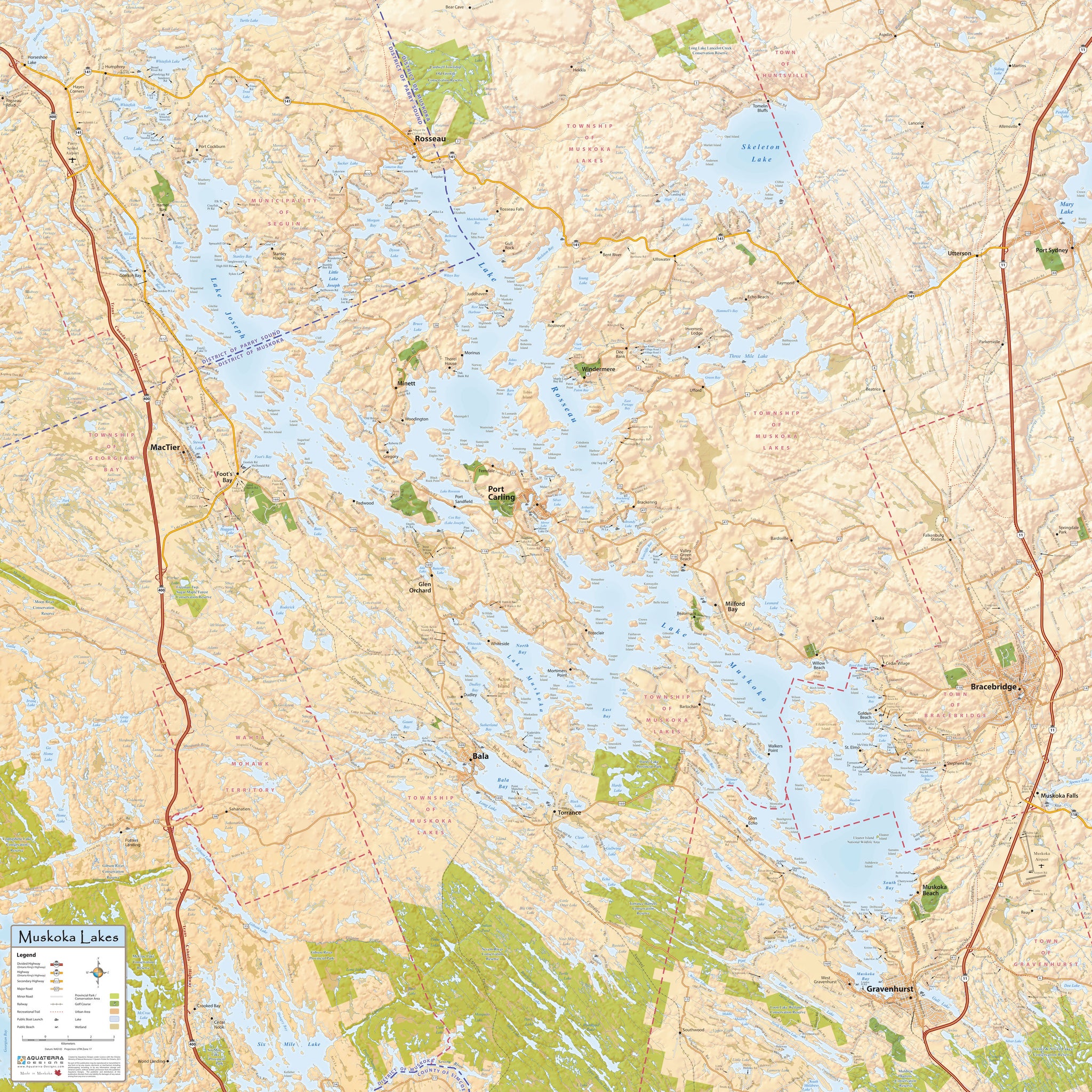
Extra Large Muskoka Lakes Wall Map (4′ tall x 4′ wide)
This large wall map covers Lake Rosseau, Lake Joseph and Lake Muskoka. With every road labelled, it is a valuable tool for all real estate professionals in the area.
The map includes a dramatic hillshade effect giving it an almost 3-D look.
Size: 4' tall x 4' wide
Coverage Area: North to Rosseau, South to Gravenhurst, East to Bracebridge, West to Highway 400
Features: Highways, Major Roads, Cottage Roads, Provincial Parks, Conservation Areas, Golf Courses, Airports, Municipal Boundaries, Towns, Villages, Hamlets, Natural Features.

Finishing Options:
Vinyl is easy to hang up and can be rolled for easy portability.
Foamboard is lightweight and looks great, with a glossy finish and can also be used with push pins.
Flushmounted is a paper print is mounted onto a 1/8" masonite, then protected by a non-glare laminate. A 3/4" box frame is mounted on the back of the masonite flush with the outside edges. The edges are finished in black. Slotted on the back, ready to hang.